NOT-LONDON 2012 Exploring Olympic venues outside the capital 2) Stoke Mandeville
London's Olympic closing ceremony will take place exactly two years from today. But that won't be the end of the show. Three weeks later the other Games kick off, the Games far fewer people follow, the Paralympics. And they have their their roots in English suburbia, 30 miles outside London in deepest Buckinghamshire. So I've been there too. After Wenlock, Mandeville.
The seeds of the Paralympics were unintentionally sown when an Aylesbury hospital was chosen for the treatment of military casualties during World War 2. A specialist spinal injuries unit was set up, whose expertise continued and grew into peacetime under the directorship of Dr Ludwig Guttmann. When London hosted the Olympic Games in 1948, hospital staff organised a special athletics event for 16 disabled ex-soldiers, and the annual Stoke Mandeville Games were born. In 1952 a Dutch team turned up, launching the first international sporting competition for disabled athletes. And in 1960 the competition ventured abroad to Rome, taking place alongside the city's able-bodied Olympics. Known at the time as the 9th Annual International Stoke Mandeville Games, this is the moment when the Paralympics are deemed to have been born. And yes, we came second. Great Britain's very good at coming second in the Paralympics, but we've never yet topped the medal table.
If you want to get to Stoke Mandeville hospital (not via an ambulance), there's one important thing to remember. Don't get off the train at Stoke Mandeville station. They have big signs up on the platforms warning you not to, and to alight at Aylesbury instead. The hospital was originally an isolation unit for cholera sufferers, so was very deliberately built in the nomansland halfway between the two settlements. Aylesbury's long since grown up and swallowed the place, but the hospital retains the name of the small commuter village down the road.
I got off the train at Stoke Mandeville, because I'm like that, although almost nobody else did. This is a sleepy Chiltern backwater, peaceful but not overflowing with character. The Post Office is the sort of place that sells Silvine exercise books and Tunnock's tea cakes. The village hall is the sort of place that hosts the Mid Bucks Rabbit Show. And the bus stop is the sort of place that boasts only five services a day, so I walked to the hospital instead. It was only a mile across the fields towards the big chimney in the distance, past a couple of extremely tame sheep, but there were rather a lot of stiles on the way so I'd never have managed the journey in a wheelchair.
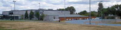
OK, so Stoke Mandeville Hospital looks very much like a modern hospital. A huge organic cluster of rambling buildings, some thrusting and modern, others barely-altered prefabs from the dawn of the NHS [photo]. The Spinal Injuries Unit is one of the more up-to-date wings, with a friendly 'Welcome' scrawled across its roof. But I headed round the bleak northern perimeter road, past several staff car parks, to catch a glimpse of the legendary stadium. There it was through the fence, behind the junior doctors' accommodation block, a ring of eight blue lanes curving off towards a distant hedge. All the usual athletics facilities, by the looks of things, including spaces for chucking things and nets for chucking them into. In fact nothing extra special at all, because this is Sport For All, and round here everyone uses the same track. [photo]
But not every sports track has an Olympic Village attached. Most of it is bungalows, obviously, in a none-too fetching shade of sludge-brown brick surrounded by unkempt shrubbery. The village was built for the one occasion the fledgling Paralympics came to Stoke Mandeville, in 1984, when the hosting honours were shared transatlantically with New York. Nextdoor is the two-storey Olympic Lodge, with a ramp, obviously, which doubles up as an accessible hotel and conference centre. And a big steely sports centre, named after dear old Dr Guttman, within which lurk a badminton hall, swimming pool and (obviously) a gym. Looking at the Aylesburyfolk walking inside to use the facilities, and pumping iron through the smoked glass windows, you'd never guess this place had any special disabled function at all.
But there's a proper hint of the old days across the car park. A row of ramshackle white huts, of the kind that ought to house a pack or three of postwar boy scouts, unsullied by upgrade since their sporting debut [photo]. One's the Shooting Hall, where wheelchair athletes won medals for target practice, and another's the Wallace-Taylor Cuesports Room, where sedentary snooker players potted black for gold. And there's an indoor bowls centre too, even though that's not a Paralympic sport any more, because they used to do things differently here.
Disabled sport has moved on big time since 1948, so that when the Paralympics return to the UK in 2012 they'll have vastly outgrown this pioneering provincial sports centre. But its legacy lives on, both around here and around the world. And it's thanks to Stoke Mandeville that in precisely two years' time the London Games won't be over, there'll still be half the fun to go.
NOT-LONDON 2012 Exploring Olympic venues outside the capital 3) Dorney Lake
Not all of London 2012 will take place in London. The football's heading all across the UK, for example, but I'm going to ignore that. Instead I'm heading off to the four other non-London venues which have been selected to host a medal-winning opportunity in two years' time. One's a heck of a long way away from the Olympic Village, while the other three are in the inner Home Counties. First up, close by, the rowing/canoeing/kayaking.
Not every Olympic venue is a drain on the public purse. This is perhaps just as well when the requirement is a category A rowing lake. To host an international level event requires a two-kilometre-long stretch of still water, broad enough for eight lanes of oarsmanship, plus a separate lake running parallel to allow competitors to return to the start. Fortunately for London 2012, one such facility had been constructed just outside the capital a few years before our Olympic bid was successful. A school pool, no less. Well, OK, it's Eton College's rowing lake. But hurrah to them, because otherwise goodness knows where the world's finest rowers would be competing.
About halfway between Windsor and Maidenhead, that's where you'll find Dorney Lake. There weren't many spots along the Thames where a 2km boating lake could have been shoehorned [aerialphoto]. Any longer and it would have joined up with the river, or else wiped out someone's garden. But that wouldn't have been a problem because Eton College own pretty much everything around here, which is probably why they can afford their own multi-million pound artificial lagoon (plus a fleet of minibuses to ferry all the scholars over). And if you've not got your own wheels (or a Thames cruiser) to get you here, it's a very long walk from anywhere.
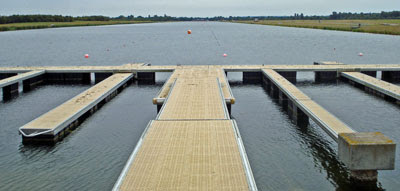
It's a damned impressive lake, though. Arrow-straight, and vanishing off into the distance as if somebody stretched an open-air swimming pool far further than they should have. At the starting end, a series of pontoons stretch out into the water like fingers [photo]. Facing each, strung out in a long line along the foreshore, stand two parallel rows of giant yellow and black shields. They look like the decoration for a very one-sided medieval jousting tournament, whereas in fact they're to give the cox something to line up with as they shoot off down the course. Pull hard, and the far distant clubhouse is less than ten minutes away.
Dorney Lake's grounds are open to the public on all but the busiestracedays, so this is an ideal spot for a walk or a ride. Cyclists are welcomed, so long as they keep out of the way of coaches with megaphones speeding along the perimeter on a bike. Even very tiny cyclists were in evidence when I visited, including some of Berkshire's youngest trying to learn how to ride one of the things in the first place. It's also a popular spot for jogging, and dog-walking, and even bird-watching if there's no regatta on the water. Swans and geese have taken to the artificial lake like ducks to water, as have the ducks, obviously. Throw in a meadowful of sheep along one side, and a recently-established arboretum on the other, and this is an attractive destination even for non-sports fans.
Strings of small white buoys mark out the eight parallel lanes, with the occasional big orange floater at strategic points along the way. A series of giant numbers count down the distance to go at 250 metre intervals, far further apart than you'd imagine they ought to be [photo]. There are squat podiums at similar intervals, some topped by a portakabin, others awaiting the BBC TV cameras which will broadcast these waters to the world in two summers time. These lie along the thin strip between the main lake and its parallel return channel [photo], which in 2012 will help to keep officials and screaming coaches out of the way of the spectating public. For now, however, it's a public walk/jog/bike-way lined by colourful marshy flowers busy colonising the water's edge.
Past 1750m, the loudspeakers begin. They were switched off during my visit because there was nothing to commentate on, no regattas or even heavy training, just a couple of quad sculls rowing weakly up-lake. Then at 2000m a final row of buoys, overlooked by the Finish Tower [photo], from whose roof terrace Pimms can be supped and photo-finishes can be judged. That was empty too, maybe because it's August and the College has packed up and gone home for the summer. The enormous clubhouse appeared to be open [photo], but I saw no evidence that visiting families and budding amateurs were being particularly welcomed to try out anything watersporty. Enjoy the perimeter, seemed to be Eton's message, but the water is ours. Elitist maybe, but it's commendable that the college are willing to share their outdoor pool with the world for a couple of fortnights, even if it brings no long-lasting public legacy. And should you fancy wandering somewhere that'll one day be on a billion TV screens, the perimeter's definitely pleasant enough.
NOT-LONDON 2012 Exploring Olympic venues outside the capital 4) Hadleigh Farm
Most of the cycling events at the 2012 Games will be taking place at the Velodrome in the Olympic Park - that Pringle-roofed stadium just off the A12. Obviously the Road Race has to take place elsewhere, where there are roads, and is likely to run from the Mall out to Box Hill and back. But one particular discipline has proved rather harder to locate, and that's the mountain biking. Because, well, London's not renowned for its contours, is it?
When London won its Olympic bid, the plan was to hold the mountain biking at the Weald Country Park near Brentwood. That's near junction 28 of the M25 - a corner of Essex not especially renowned as mountain country (indeed the highest point in the park is no more than 100m above sea level). The International Cycling Union were not impressed. Not hilly enough, they said, not enough challenge, have you got anywhere else? So London 2012 looked around Essex (because they'd promised the mountain biking to Essex) and tried to see if there was anywhere steeper that they could carve out a course instead. Yes, obviously, Canvey Island.
OK, not quite Canvey, but a hill on the mainland at Hadleigh which looks out towards the pancake-flat isle. The hilltop may be only 70 metres high, but it has far more exciting slopes than the Weald, so it's been deemed excitingly acceptable by the powers that be. Which means that, on the final two days of Olympic competition, 30 women and 50 men will be coming to Essex to test out their skill, balance, daring and verve on cross-country saddleback. It's just a pity that, with so many other events scheduled for that weekend, so few TV viewers will be watching.
Hadleigh's not a town that's used to the spotlight. A few streets before Southend, where the A13 dual carriageway fades into a bus garage and a parade of shops, that's the heart of Hadleigh. Take Chapel Lane down towards the river and eventually you'll reach a poorly used car park beside a fake Iron Age Roundhouse. This lonely spot is currently the gateway to Hadleigh Country Park, but come 2012 it'll be transformed into the official Olympic car park (for official Olympic vehicles). From here it's but a brief freewheel into the field where the mountain biking course is located, or at least it will be once the whole shebang is ready. It isn't yet, but they've already made a start.
A public footpath crosses Sandpit Hill, which is the uplifted zone selected for international competition, but alas it's not public any more. The stile leading off from the lane has been fenced over, and someone's erected a "temporary footpath diversion" sign which looks anything but temporary. No doubt it's only for a couple of years, although any determined intruder could easily nip over the netting and wander around the entire course to their heart's content. Law-abiding souls have to walk a little further down the track, then turn off through a parallel field, from where there's a pretty good view of what's been built so far. [photo]
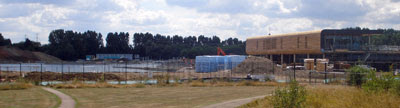
There's not much to see yet, to be honest, just a few sinuous paths cut into the hillside and surrounded by flapping orange netting. It's not yet clear whether these are tracks for competitors or access routes for spectators, probably the latter. But what is clear is that there are definitely enough contours here - nothing too precipitous, but equally nothing too restrictively feeble. There's also every chance of a mudbath should the clouds open during the week before the competition. My boots got absolutely covered in sludge during my wanderings in the local area last weekend, and I had to endure more than one awkward scramble down a treacherously slippery mudslide. Even if the rest of London 2012 is thwarted by torrential rain, at least here it'll make for some damned fine competition.
The site has one further bonus, which is the presence of a haunting Norman ruin on the hilltop nextdoor. This is Hadleigh Castle, once an important Thames-side citadel and a favoured residence of Edward III. No longer. The walls have almost all fallen, which is what happens over the centuries when you pile large chunks of stone on top of an unstable clay outcrop. A few outline foundations remain for visitors to pick over - that's part of the great hall, there's the kitchen, and that's the floor of the King's old bedroom. Some of the original towers still stand, most only barely (thanks to a long-ago landslip), but one as half a shell looming high above the marshland below. No French invaders pass upriver these days, only a succession of huge container ships and tankers heading towards the chimneys of Corringham. Southend is clearly visible to the east, while the flat wastes of the Isle of Grain fade off to the horizon across the snaking river. As the estuarine Thames goes, this is definitely one of the prettierspots (although admittedly it hasn't got much competition). [photo]
One further point of interest can be found a few hundred yards inland from the castle - the Salvation Army's Hadleigh Training Centre. William Booth created the Home Farm Colony here in the 1880s "for the benefit of men who, through misfortune, need a helping hand." The Army continues its sterling work in the local community to this day, but the skills offered now are rather less manually-based than before. Having said that, they do run a Rare Breeds Farm which is open to the public every summer, and which four-year-olds are bound to find more exciting than a wander round some old ruins. There are also tearooms, I think inside a mighty big chalet, although a shocking lack of publicity meant I only worked out they were tearooms from the internet once I got home. They'll stay open during the Games in 2012, you'll be pleased to hear, even if the castle will be blocked off to stop spectators getting too good a free view. No problem. The mountain biking's one event, I suspect, it'll be well worth paying to see.
One of the more spectacular Olympic sports is the canoe slalom. Lots of splashy white water, several flashing oars, and some very wet athletes careering downhill to a frothy finish. Again, fairly easy to organise if you have a mountain to hand, but rather harder when the land's flat. So, this time, destination Hertfordshire.
The plan was always to hold the slalom events somewhere in the Lea Valley. A short trip upriver from the Olympic Village, and a course that would provide a long-term sporting legacy for local residents. So a former industrial site was identified Broxbourne station and the river, and plans made for a Games-standard whitewater course. That was the plan. But the Spitalbrook site turned up to be more deeply contaminated than anyone had guessed, and would have cost millions to clear up. So an alternative location was sought, as a matter of urgency, but still in the Broxbourne area because they'd hate to let the local council down. Which is how a whopping great building site ended up on a greenfield site halfway between Waltham Cross and Waltham Abbey.
There are several ways to get to the new Lee Valley White Water Centre. The official recommended route is via Cheshunt station, not because it's the closest but because it has the most frequent rail service. It's ideally located for the river, is Cheshunt station, if not for the surrounding town. It's also perfect for the Lee Valley Youth Hostel, amongst whose smart fresh chalets an information point has been set up for those wishing to find out more about the new venue. They're very keen to get visitors, by the looks of it, because the existence of this information centre is advertised on signposts and posterboards in the middle of nowhere up to a mile away. But it's not really worth a half hour detour to reach. A small unstaffed room off the main hostel reception, with a few big photos on the wall and a whitewater video and a web terminal that doesn't work. Oh, and plenty of information, which manages to make the new course sound fairly exciting. But not very nearby.
The most direct route is via TheobaldsGrove station. You've probably never been, but this was the nearest station to my gran's house while I was growing up, so I know it all too well. Then down Trinity Lane, past the parish church where my parents got married, and across the unmanned level crossing onto Cheshunt Marsh. It's more than pleasant here, within the boundaries of the Lee Valley Park. Rolling water meadows edged by flowery undergrowth, and a speckling of streams and lakes threading through verdant woodland. All except for one patch of land to the south, where a sprawling building site has been rudely plonked. The Olympic planners have attempted to destroy only mown grassland and a car park, but this corner of the marsh has been irrevocably changed. Down that blocked footpath, behind that temporary fence, the whitewater slalom course is taking shape.
The best views of the new centre are from the edge of the Lee Navigation. Cross over the footbridge (from Essex into Herts) and you can look down on the emergent course from a hump in the path. Last summer nothing was here but a huge pile of earth [photo], but 12 months later there's almost enough infrastructure here to paddle down [photo]. At its heart is a timber-framed building shaped like a hardback book, with a sweeping wooden terrace stretching out above the starting pool for the Olympic course. The water level only drops five metres from start to finish, but the gradient's steep enough to provide a rocky ride for the professional canoeists. The pumps were switched on for the first time last week to check that the course doesn't leak, and the good news is that everything appeared to splish and splosh appropriately [video]. I visited a few days too early to see any of that, so had to make do with a vague glimpse of the pre-filled lower pool surrounded by snapping diggers [photo]. It's possible to get a better view of the central facilities building from further along the towpath, hovering above ground level like a floating encyclopaedia. But the path's too low down, and the main course too far away, to get a decent glimpse of any Olympic water whatsoever. Never fear, potential 2012 spectators, because a special earthy lump is being piled up for thousands of you to sit on, and there'll be a much better view from up there.
One final way to reach the Centre is along Eleanor Cross Road from Waltham Cross station. Unfortunately this only works at the moment if you're an Olympic contractor. This is the official entrance, the one with smart graphic pictograms hanging from the gates, and the one that everyone will be using in 2012. And in 2011, because the unique thing about this particular Olympic venue is that it'll be open to the public one year early. If you fancy trying your hand at the scary slalom, or more likely a bit of rafting down the separate intermediate circuit, turn up here from spring 2011 onwards and get your feet wet. Certainly Broxbourne Council are more than delighted with their new world class watersports venue, and are crowing about its existence on banners hung all along the adjacent roadway. Local landlubbers may not be quite so pleased at swapping grassland for white water, but officials hope that tens of thousands will take full advantage once the slalom gates open.
The Serpentine doesn't really cut it as an Olympic sailing venue, so all the yachters and sailspersons are off to the Dorset seaside instead. A full 120 miles from the main stadium, in the lee of the Isle of Portland, they'll be all a-flutter come 2012. To conclude my summer series, here's one final report from an out-of-London Olympic venue.
The best sailing waters in Northern Europe are to be found in Weymouth Bay. Lucky, that. The waters are protected by coast on three sides, with only the non-prevailing easterlies able to blow in unhindered. But even that wasn't good enough for the Royal Navy, who in the mid 19th century built a series of breakwaters to create one of the largest man-madeharbours in the world. Prince Albert laid the foundation stone - and there aren't many other Olympic venues which can claim the same thing. The Navy sold up in 1996, allowing the watersports industry to move in instead, and the Weymouth & Portland National Sailing Academy was established four years later. One nigh-perfect global sailing venue, up and running in advance of London 2012's successful bid, and making barely a scratch on the Olympic budget.
The WPNSA can be found off the northern tip of the Isle of Portland, on reclaimed land in the lee of Chesil Beach. Don't think glamour. The inshore area at Osprey Quay is covered with car parks, metal sheds and a heliport. As for the boatyard, that's shielded behind metal railings to keep mere landlubbers at a safe distance. The fence isn't standard Olympic issue, no mile-high razorwire or anything, but no doubt that'll change once 2012 comes around. The clubhouse is a blue toastrack of a building, not as capacious as you might expect, and with its most interesting side out of sight facing the waters. Hundreds of high-masted boats are lined up nearby, some on the tarmac, the rest spaced out along pontoons in the water. Pick your weekend carefully and the harbour is a mass of flapping white sails tacking across the waves, and a quite magnificent sight. I picked my weekend less carefully, and got a few racing canoes instead.
Nextdoor is the Portland Marina, a commercial proposition which meets the needs of the more aspirational yacht owner. They have a two-storey restaurant called "The Boat That Rocks", named after last year's pirate radio film which was shot around here. How long the name survives remains to be seen, but the place was packed out with boating clientèle when I walked by. I doubt that many of these diners came from the local area, but one day soon they will. Some gleaming green-domed apartments have just been finished nearby, looking wildly out of place like they were meant for the Battersea riverside. In the meantime Castletown on the rim of the island is little more than one weatherbeaten street, lined by grand hotels whose glory days are long past and the occasional dead pub. Further up the hillside are the outskirts of Fortuneswell, a patch of council housing strung out like fingers along the upper contours of the island. [photo]
These two settlements are joined by the Merchant's Incline, a steep footpath once used for the haulage of Portland stone down to the docks below. It's well worth making the climb to the top, turning round occasionally to stare back at the panorama below [photo]. The best view is from outside the gates of HM PrisonThe Verne, hidden in the rockface at the very peak of the island. From here the entire bay is spread out below, with a focus on the protected waters inside the Portland breakwaters [photo]. This'll be a great spot from which to watch the Olympic yachting in 2012, even though you won't have a clue who's winning. You probably won't even need a ticket. Sailing's traditionally been a free-to-view Olympic event, and it's likely that the cliffs will stay open to all throughout. Hospitality enclaves and spectator boats may be introduced at sea level, and they'll no doubt cost a small fortune, but the slopes of Fortuneswell offer as fine an overview as one could hope to find.
The Walbrook is one of the most important rivers in the world, which is pretty impressive for a river that no longer exists. It's not as important as the Thames, obviously, but the spot where these two rivers met defined the nucleus of a great global city. The City of London emerged along the line of this shallow river valley rolling down to the Thames, then spread across the contours of two low hills rising to either side. Drinking water, defensive position, strategic location, perfect. Those two hills still exist, with St Paul's Cathedral marking Ludgate Hill to the west and the Royal Exchange atop Cornhill to the east. But the Romans wouldn't recognise the valley which once divided their walled city into two halves, because the sparkling river has irreversibly vanished.
The Walbrook is therefore incredibly difficult to follow. You'd think it would be easy, passing as it did through one of the most well-documented square miles on the entire planet. But this means it disappeared early, several centuries before any other London lost river bit the dust. What had once been a "fair brook of sweet water" had by the 13th century become an ugly sewer that was "neither fair nor sweet". The middle and lower reaches of the Walbrook were paved over in 1463 thanks to a hygiene-minded Royal Act, and the original watercourse hasn't been seen since. Few accurate maps of the area were drawn up in medieval times, and the landscape has been built upon and built upon and built upon over the intervening years. So the account I'm publishing below is based on historical scraps I found in books, some approximate published maps and a bit of guesswork.
THE LOST RIVERS OF LONDON The River Walbrook 1) Shoreditch - Liverpool Street
Trying to locate the source of the Walbrook is fraught with difficulty. It's said by some to have arisen in Moorfields - once a large area of marshy fenland outside the City walls, broadly where Moorgate station and Finsbury Circus stand today. If so, expect the stream to have 'emerged' and 'coalesced', rather than bubbling forth from one distinct spring. Others think there were lots of tiny brooks draining a wider area to the north of the City. If so, then as one modern hydrologist has it, "Walbrook is merely a generic term for a network of convergent southbound streams". A third group are convinced that the river had slightly longer tributaries, probably two, one of which flowed down from Islington and the other from Shoreditch. If so, they'd probably have been pretty piddly streams, possibly only much in evidence after a decent amount of rainfall. I've decided to run with this third option, because I've seen it in print most often. Starting in Shoreditch.
You'd think "Shore Ditch" was a sure fire reference to something lost river-y, but apparently this isn't the case. There was a wellspring here once, allegedly, close to the Roman road junction outside St Leonard's Church[photo], and this could have been the Walbrook's most northerly source. Don't go looking for any evidence on the ground, but the blogger at Spitalfields Life has had a long chat with the vicar and he assures us the river once flowed from here. The fledgling Walbrook would have dribbled south through the heart of trendy Shoreditch [photo], quenching the bar-ghetto between Curtain Road and Shoreditch High Street [photo]. Precisely here could be found Shakespeare's first two London theatres - The Theatre and The Curtain - so it's a pretty good bet that young Will relieved himself into the Walbrook on a number of occasions.
The river would have followed the line of the old Broad Street Railway, which may or may not be a lucky coincidence. It entered the modern City of London beneath the Broadgate Tower[photo], the ancient valley now marked by a chasm of glass and steel between lofty heights [photo]. And then south across the extensive financial wastes of the Broadgate development. You'll find no medieval street patterns here, just a warren of mighty office blocks dumped down where Broad Street station and its sidings once stood. Seething with suits from Monday to Friday, at weekends its solitary piazzas echo with workmen, cleaners and the occasional lost tourist [photo]. Running parallel to the rail terminus at Liverpool Street [photo], it's here at ye olde Moorfields that the Walbrook proper began.
THE LOST RIVERS OF LONDON The River Walbrook 2) Liverpool Street - Bank
The Walbrook entered Roman Londinium through a culvert under the citywalls about halfway between Moor Gate and Bishop's Gate. It brought fresh water for drinking and cooking, so it was allowed to pass unhindered beneath the ragstone bulkhead. And as the brook beneath the wall, that's how the Walbrook got its name. Probably. Very little about this river is certain, you should know that by now.
The entrance point today is marked by an unlikely dual carriageway sloping down past the church of All Hallows On The Wall. This building is a rare survivor in a sea of modern architectural tedium, although at the top of the hill the new spire-topped Heron Tower injects a striking contrast into the skyline [photo]. And then on into the city proper, and an area you way not know too well. There are a lot of gates and walls and narrow alleyways, as if those round here would rather not too many of the outside world wandered by. If Throgmorton Avenue's locked off then slip down the nearby passage and enter the mysterious enclave around Austin Friars[photo]. Wiggly lanes lined by obscure financial institutions, plus De Nederlandse Kerk (which has been serving the capital's Dutch community since 1550). Alas the Walbrook ran slightly further west, past Drapers Hall, through what's now the chunky brown lump of Angel Court. Over the last fifty years, it seems, architects have infilled umpteen corners of our great City with stacked-office ugliness.
To Tokenhouse Yard. This is a neat yet non-descript EC2 cul-de-sac, with a narrow alley at one end leading to a snack shop and gentleman's barbers. Along one side is an elegant façade with classical columns, and along the other a building site [photo]. Really quite typical. But this is apparently the spot where two tributaries of the Walbrook met. Above this point marshy uncertainty, below this point a fairly definite river course. There's even a map of the Walbrook stuck to the building site wall, because construction projects in the City have to take archaeology very seriously. Roman remains (including a timber-lined drain) have been found beneath basement level, the poster informs, as well as telltale lost-river alluvium. London's original watery dividing line passed straight through here, then south to Lothbury.
Not many medieval churches had to be specially constructed so that a stream could pass underneath! By the time Wren rebuilt St Margaret's after the Great Fire there was no need for special vaulting as there was no longer a river [photo]. But there were genuine underground issues at the next building across the street - the mighty Bank of England[photo]. Sir John Soane had to deal with the buried Walbrook when he designed and constructed the City's financial fortress - its waters were seen trickling beneath the foundations. A similar, though unexpected, archaeological revelation occurred in the late 1950s when the "Travelator" at Bank station was being installed. Next time you're walking down to the Waterloo & City line on Europe's first moving pavement, be aware that you're also wading through the channel of the deep-buried Walbrook. [photo]
THE LOST RIVERS OF LONDON The River Walbrook 3) Bank - Cannon Street
The Walbrook lives on, in name only, in the heart of London. One of the City's 25 electoral wards is named after the river, which once ran precisely along the ward's historic western border. There's a street called Walbrook[photo], and has been for centuries, which may be short but boasts the Mayor's Mansion House at its head. Nextdoor is a church named St StephenWalbrook - one of Sir Christopher Wren's finest post-conflagration rebuilds, and also the institution responsible for founding the Samaritans helpline in 1953 [photo]. In sharp contrast alongside is a ribbed black office block in an upturned-jelly style, nearing completion and to be known by its new tenants as the WalbrookBuilding[photo]. But the river didn't quite flow past all this lot, down the street that bears its name, but instead about 50 yards or so to the west.
This is a right ugly chunk of London, unless you're into near-demolishedModernist office blocks [photo]. Bucklersbury House and its neighbour Temple Court were knocked up in the 1950s, and will be knocked down very shortly. While the wrecking balls wait and a locked fence keeps Londoners at bay, Legal & General's flapping windows now let in the rain. One ancient relic survives on view - the Roman Temple of Mithras. its stonework was discovered by workmen while Bucklersbury House was being laid out in the 1950s, and archaeologists subsequently recovered several marble sculptures of gods and goddesses from the dig. The finest relics were put on display in the Museum of London, while the temple was rudely shifted to its current position on a gloomy raised platform beside Victoria Street [photo]. If sufficient money is ever forthcoming, a new development called Walbrook Square will be constructed on the site, with the re-relocated Temple of Mithras at its heart. Judging by the plans, there'll be few mourners when the demolition balls swing for Walbrook Square in 50 years time.
The Walbrook crossed Cannon Street precisely where today's contours suggest it did, beneath Horseshoe Bridge to the west of the current station. The next street down is Cloak Lane, formerly Cloaca Lane (after the Latin name for sewer, which tells you all you need to know about the medieval smell locally). Here could be found the church of St John the Baptistupon Walbrook, one of the unlucky City churches not chosen to be rebuilt after 1666. It suffered a further blow when the District line ploughed through the churchyard in the 1880s, and all human remains were disinterred into a small barred vault (which, unexpectedly, can still be seen). And then comes Upper Thames Street, which marked the line of the quayside in Roman times but is now an unpleasantly busy arterial road. One of the main gates in London's defensive wall was here, named Dowgate. The Walbrook here was 14 feet wide as it flowed out into the Thames - an improbable fact which you can ponder while sitting in Whittington Garden watching the pigeons in the fountain. [photo]
As Londinium expanded inexorably to become London, the mouth of the Walbrook gradually migrated south. The river flowed between dockside wharves to join the Thames about 120 feet to the west of Cannon Street station, where it's still possible to see a concrete trough at low tide marking the end of the London Bridge Sewer[photo]. This is also the spot from which the City chooses to despatch its rubbish. Containers of reeking refuse are piled up at WalbrookWharf until high tide when they're taken away by barge to some unfortunate part of Essex. The barges have lost-river-related names (Walbrook, Holebourne, Turnmill etc) and they're huge, especially when viewed from the pebbly beach [photo]. Access is along the edge of the station, past the chlorine-pumping gym and down a set of slippery steps beside The Banker pub, should you fancy a spot of mudlarking. The beach is littered with fragments of brick, tile and china, as well as rounded glass fragments and considerably more seashells than you might expect. A row of damp squidgy wooden posts marks the line of some old jetty [photo], and the smell of rotting vegetables and vinegar hangs in the air. That'll be the Walbrook - long vanished on the ground, but impossible to disguise.
If the Fleet is North London's iconic lost river, then South London belongs to the Effra. It's got a brilliant name for a start. Nobody's 100% sure where the name came from - possibly from "efre" the Anglo-Saxon word for 'bank', or from "yfrid" which is the Celtic word for 'torrent'. I'm not entirely convinced by the latter, given that this six mile stream could never genuinely be described as torrential. There are a few semi-steep slopes at the Norwood end, but any lower the gradient's so shallow you'd never guess there was ever a river here. Through Brixton down to Vauxhall, the Effra's long gone.
Two centuries ago, if you'd have been standing in the rural wilds of what is now the London borough of Lambeth, a small brook would have trickled by. It ran through fields and meadows and peaceful countryside - a landscape almost impossible to imagine today. Norwood really was a wood, Brixton was only a few scattered cottages, and Kennington was just a big common where convicted criminals got hung. The Effra widened as it flowed towards the Thames, eventually broad enough for a small boat, but for most of its length think 'paddling-depth stream' and you'll not go far wrong. Then came the railways, and the onslaught of suburbia, with housing easily built on the raised terraces above the floodplain. The Effra dwindled to an unwanted sewer, covered over around the same time as the Albert Embankment was built, with its waters culverted and buried.
The original Effra wasn't simply one river, it was a series of tiny tributaries covering a broad catchment area. Most of these ran down from a long ridge of high ground running roughly from Sydenham to Crystal Palace. One of these tributaries, for example, was known as the Ambrook. It kicked off in Sydenham Hill Woods (across the valley from the Horniman Museum), where there are still ponds and occasionally-damp channels to be found in the undergrowth. A poorly-used railway once ran thisway, along an artificially flat terrace leading to a bricked-up tunnel under Crescent Wood Road. The Ambrook, meanwhile, ran downhill across what is now Dulwich Golf Club, past Dulwich College towards the main Norwood trunk of the river.
I'll not be writing much about the Effra's many tributaries. It would take too long, and others have done the job too well anyway. Here for example is a fine page about the geology and geomorphology of the Effra basin, which contains far more proper detail than I'm going to write about below. And here's Edith's blog, currently following the various Effratributaries and writing about what's there now and what was there then. The historical detail is fantastic, and again is far more useful than the skim-past I'm going to deliver here.
The Effra lives on as an urban legend, untraceable for most of its length by the uninitiated, apart from the odd major road in the Brixton area since named after it. There are occasional attempts to resurrect its memory, most notably in 1992 when a local arts group opened up an office under the banner of the "Effra Development Agency". Theirs was a tongue-in-cheek attempt to inspire a revival for the river valley, much as the unloved Docklands had recently been reborn. Posters and newspapers amplified the message, only for a short time, but long enough to lodge the river firmly back in south London consciousness.
As for raising the river back above ground, I really wouldn't recommend it. An awful lot of Victorian terraces would become uninhabitable, the centre of Brixton would switch from market to watergarden, and there's even a major cricket ground where the boundary might become a water hazard. Better that we remember where the Effra used to run, and recognise the enormous influence it's had on settlement and communications. Starting tomorrow, up Crystal Palace way.
If you're especially interested (and south Londoners tend to be rightly passionate about their own patch), the Brixton Society published a 28 page booklet about The River Effra back in 1993. It has a full history from source to mouth, plus a proper map without which I'd have got proper stuck while producing what follows. The Society's website alleges that it's available for £1.50, if indeed it's still in print, although I found a copy lurking upstairs in the Local Studies section of Brixton Library.
THE LOST RIVERS OF LONDON The River Effra 1) Norwood
The chief headwaters of the Effra arose from springs in Upper Norwood, approximately where Westow Park stands today. That's just off the Crystal Palace one-way system, if you're trying to find it, between the Sainsbury's superstore at the top of the hill and the tower blocks of College Green partway down. Should you ever walk the Capital Ring you'll pass straight through, probably rapidly, before moving on to the slightly more interesting Upper Norwood Recreation Ground. A small patch of grass in the eastern corner often appears damp, if not outright wet, hinting that the river has refused to disappear completely. The drinking fountain nearby's not Effra-fuelled, alas, it's too high up. [photo]
Even in its first half mile, the valley carved by the fledgling Effra is clearly evident. It flows along a pronounced depression beyond Chevening Road, now infilled with housing and a school, but once the site of nothing more than a four-plank bridge. Traffic negotiating Hermitage Road from ridgetop to ridgetop must descend steeply, then climb again, to cross the broad valley of a vanished stream [photo]. But trace the river along Hancock Road, to a grassy verge at the end of a short cul-de-sac, and it's still possible to hear 21st century Effra waters rushing beneath an anonymous manhole cover [photo]. Allegedly, that is - I'd recommend not wasting your time listening to find out.
Legend tells that Queen Elizabeth I's royal barge once sailed up the Effra as far as Hermitage Road. A quick glance at the gradient of the hill beneath this spot should be sufficient to confirm that this supposed regal voyage never took place. After exiting the grounds of VirgoFidelis convent school, the Efrra emerged onto flatter ground through an obvious dip between Crown Dale and Central Hill [photo]. It then curved across Elder Road into what is now municipal Norwood Park, close to the multi-purpose sports court. In the early 1800s this stretch of the Effra marked the western boundary of Great Elderhole Coppice - one of the last surviving remnants of the 1400 acre Great North Wood (after which the suburb of Norwood was named).
This area has long been susceptible to flooding. A particularly heavy storm on 17 July 1890 caused the Effra to become a raging torrent, sweeping away part of the Virgo Fidelis convent wall. Repairs in the brickwork are still visible to the right of the school gates. Properties in Elder Road were also badly affected. A plaque marking the 1890 flood level is alleged to exist on the south wall of the Outdoor Relief Station at Elderwood Place[photo], although I've looked and looked (as much as any man can without trespassing) and I can't see a thing. I even asked the owner of a neighbouring cottage, and she told me she'd been living there for 30 years and had neither seen nor heard of it.
The river valley remains more than obvious here, dipping across suburban sidestreets to the east of Elder Road. At Gipsy Road's lowest point, beside the rear entrance to Lambeth's pupil referral unit, stands a mysterious green post [photo]. At pavement level it looks like a fairly ordinary lamppost, apart from the fact that it's the wrong colour, ribbed and rather thicker than usual. Look up and you'll see there's no lamp atop the column, just a pipe open to the sky, and considerably taller than the commonplace telegraph pole alongside. Because this green post is a Victorian stinkpipe, erected to provide essential ventilation for the sewer that now passes immediately beneath. One hopes that local residents don't need to keep their windows closed during hot weather as a result.
The river hugged the railway (or, chronologically speaking, the other way round) on its approach to West Norwood station. At the foot of Pilgrim Hill there's a business-like address called "The Boat House", which geographically could have been true, but I suspect is little more than a coincidence. Immediately before the station comes East Place [photo], currently little more than a row of arches where cars get mended and deals get struck. Here in June 1914 the floods struck again as the sewers bubbled up - trapping animals, inundating cellars and ruining many a Sunday roast. A more effective flood relief sewer was built later, and this protects even those asleep within West Norwood Cemetery from any unexpected deluge.
THE LOST RIVERS OF LONDON The River Effra 2) Dulwich/Herne Hill
The Effra exited West Norwood through its cemetery. This is one of London's Magnificent Seven cemeteries, is West Norwood, containing some of the finest funereal monuments in the capital. Obelisks, mausoleums, catacombs, that sort of thing, all jammed together in a beautiful higgledy-piggledy configuration [photo]. Sugar magnate Henry Tate, cookery goddess Mrs Beeton, even the Charlie who launched the FA Cup, they're all buried here. As too is the Effra, now landscaped out of all existence.
After crossing several residential streets to the north, the Effra met up with an incoming tributary close to West Dulwich station. Nearby is Belair Park, which may be the only place where the river Effra can still be seen on the surface. The park's tree-lined lake certainly looks convincingly river-ish. It's long and sinuous. It has reedy banks where waterfowl bask and feed [photo]. And it lies roughly along the same north-south alignment as the original stream. It could easily be a last remaining chunk of river, or a tributary amputated for decorative effect. All that's certain is that a lake existed here in 1785 when the surrounding estate was leased from Dulwich College by John Willes, a Whitechapel corn merchant. His grand house, later named Belair, grew over the years to become a 47-room mansion. Today it's rather smaller, restored by the council and used as a restaurant[photo], but the lake still forms the ornamental centrepiece of its grounds.
Onwards to the point where Half Moon Lane meets the eastern tip of Brockwell Park - a road junction originally known as Island Green. Victorian art critic John Ruskin grew up close by, and recorded his memories of the Effra for future generations. He was four years old when his parents leased a grand house atop Herne Hill, from which he recalled a southern descent "beautifully declining to the vale of the Effra". Later in his childhood, in the 1820s, the river was "bricked over for the benefit of Mr Biffen, chemist, and others." Aged 13 he sketched a view along Norwood Road at the foot of the hill. This was "just at the place where, from the top of the bridge, one looked up and down the streamlet, bridged now into putridly damp shade by the railway, close to Herne Hill station. This sketch was the first in which I was ever supposed to show any talent for drawing." All that flows across the foot of Herne Hill today is a relentless stream of vehicles, and the restructuredtraffic island opposite The Chutney restaurant is no place for any aspiring young artist. [photo]
The 19th century Effra ran along the eastern edge of the Brockwell Estate (now Brockwell Park), tamed to run in a channel alongside Water Lane (now Dulwich Road). That's the opposite side of the road to BrockwellLido, whose presence today is a mere watery coincidence [photo]. South of the Prince Regent tavern a series of footbridges led across the stream into the grounds of seven detached villas, while beyond lay an expanse of market gardens. Although the river's gone, three telltale green pipes mark the progress of its replacement sewer alongside Dulwich Road [photo]. One stinkpipe stands tall in front of the Meath Estate [photo], opposite the Lido, while the other two are at the northern end beyond Chaucer Road. [photo]
Meanwhile, back on the western slopes of BrockwellPark, it's possible to trace one of the Effra's many tiny tributaries. Its course survives, somewhat artificially, as a series of three linked ornamental ponds. The highest of these was once a Victorian bathing pool, while the other two remain out of reach to all but the local waterfowl [photo]. A short stretch of potentially-genuine stream meanders down beneath the lowest cascade, on whose banks grow yellow iris, pendulous sedge and hemlock water-dropwort. Not quite how the Effra used to be, but about as close as you're ever going to get. [photo]
THE LOST RIVERS OF LONDON The River Effra 3) Brixton
Two street names in south Brixton appear to provide a very obvious reminder of the river's former passage [photo]. Effra Road is one and Effra Parade the other, the pair linked by the very rivery-sounding Brixton Water Lane. But neither runs along the former route of their eponymous river, which instead meandered through former farmland between the two. In medieval times this area was part of the Manor of Heathrow (nothing airport-related, merely 70 acres of agricultural freehold). Over subsequent centuries it's possible that typically lazy London pronunciation – casual dipthongs and dropped aitches – caused the manor's name to evolve from Heathrow via Hethra to Effra. A likely story.
By the early 19th century the river valley south of Coldharbour Lane belonged not to Heathrow Manor but to Effra Farm. And it was this lowly half-mile swathe of rural meadow and market garden which, it's believed, lent its name to the entire river. Effra Road started out in 1810 as a quiet track along Effra Farm's western boundary (the former farmhouse is marked today by the Effra Road Trading Estate). Improved road access soon encouraged property development which devoured the entire farm site, with Effra Parade part of the second wave of building in the 1830s. For a glimpse of how things used to be, crouch down on the pavement outside the Happy Shopper on Effra Parade[photo]. Beneath the minimart window is a tiled panel, origin unknown, depicting a sylvan scene of the Effra from yesteryear. A river curves through open fields past some pristine farmhouses and an unlikely blue cow. It could be any imaginary river anywhere, to be honest, although let's give the artist the benefit of the doubt and believe it's Brixton's Effra.
Proceeding northwards comes the Effra Hall Tavern - unrelated to the old river except in location [photo]. The stream then wiggled north beneath Coldharbour Lane, once a rural thoroughfare, now at the heart of bustling Brixton. This historical legacy was exploited one summer Saturday in 1998 by a bunch of anti-car protesters calling themselves the "Effra Liberation Front". They blocked off the western end of Coldharbour Lane (and a chunk of neighbouring Brixton Road) to make their point, and five thousand people attended the street party that ensued. As for liberation, however, a few hastily-filled paddling pools were the only evidence of surface water.
Romantic though it might seem to "reclaim" the Effra, Brixton's residents probably wouldn't appreciate the upheaval. Rehabilitation would require roadworks to reinstall a bridge across Coldharbour Lane [photo], the flooding of one of Brixton's famous covered market arcades[photo], a ford bisecting the eastern half of Electric Avenue[photos] and a new channel dug through the motley collection of shops beneath the station. More radical souls might however delight in the demolition of Brixton Police Station, itself first housed in a hut on a bridge above the Effra.
Between Brixton and Kennington the river ran for about a mile immediately along the eastern side of Brixton Road. The Effra here might still be visible had Baron Henry Hastings, 17th century resident at nearby LoughboroughHouse, lived a few years longer. Parliament granted him the right to make the river navigable from Brixton to the Thames, but on his death the plans fell through. Instead this stretch of the Effra, known locally as the Shore, remained for drainage only. By the 19th century the road/river combination had become the Washway, "so called from its low and plashy state". Handsome townhouses and ornamental villas grew up on each side, some accessed by means of small wooden bridges across the lilac-banked stream. 21st century Brixton Road is rather less idyllic, but the broad strip once occupied by the pastoral Effra is still evident in front of some of the older terraces on the eastern side. [photo]
 ND
NDThe seeds of the Paralympics were unintentionally sown when an Aylesbury hospital was chosen for the treatment of military casualties during World War 2. A specialist spinal injuries unit was set up, whose expertise continued and grew into peacetime under the directorship of Dr Ludwig Guttmann. When London hosted the Olympic Games in 1948, hospital staff organised a special athletics event for 16 disabled ex-soldiers, and the annual Stoke Mandeville Games were born. In 1952 a Dutch team turned up, launching the first international sporting competition for disabled athletes. And in 1960 the competition ventured abroad to Rome, taking place alongside the city's able-bodied Olympics. Known at the time as the 9th Annual International Stoke Mandeville Games, this is the moment when the Paralympics are deemed to have been born. And yes, we came second. Great Britain's very good at coming second in the Paralympics, but we've never yet topped the medal table.
But not every sports track has an Olympic Village attached. Most of it is bungalows, obviously, in a none-too fetching shade of sludge-brown brick surrounded by unkempt shrubbery. The village was built for the one occasion the fledgling Paralympics came to Stoke Mandeville, in 1984, when the hosting honours were shared transatlantically with New York. Nextdoor is the two-storey Olympic Lodge, with a ramp, obviously, which doubles up as an accessible hotel and conference centre. And a big steely sports centre, named after dear old Dr Guttman, within which lurk a badminton hall, swimming pool and (obviously) a gym. Looking at the Aylesburyfolk walking inside to use the facilities, and pumping iron through the smoked glass windows, you'd never guess this place had any special disabled function at all.
Past 1750m, the loudspeakers begin. They were switched off during my visit because there was nothing to commentate on, no regattas or even heavy training, just a couple of quad sculls rowing weakly up-lake. Then at 2000m a final row of buoys, overlooked by the Finish Tower [photo], from whose roof terrace Pimms can be supped and photo-finishes can be judged. That was empty too, maybe because it's August and the College has packed up and gone home for the summer. The enormous clubhouse appeared to be open [photo], but I saw no evidence that visiting families and budding amateurs were being particularly welcomed to try out anything watersporty. Enjoy the perimeter, seemed to be Eton's message, but the water is ours. Elitist maybe, but it's commendable that the college are willing to share their outdoor pool with the world for a couple of fortnights, even if it brings no long-lasting public legacy. And should you fancy wandering somewhere that'll one day be on a billion TV screens, the perimeter's definitely pleasant enough.
OK, not quite Canvey, but a hill on the mainland at Hadleigh which looks out towards the pancake-flat isle. The hilltop may be only 70 metres high, but it has far more exciting slopes than the Weald, so it's been deemed excitingly acceptable by the powers that be. Which means that, on the final two days of Olympic competition, 30 women and 50 men will be coming to Essex to test out their skill, balance, daring and verve on cross-country saddleback. It's just a pity that, with so many other events scheduled for that weekend, so few TV viewers will be watching.
There's not much to see yet, to be honest, just a few sinuous paths cut into the hillside and surrounded by flapping orange netting. It's not yet clear whether these are tracks for competitors or access routes for spectators, probably the latter. But what is clear is that there are definitely enough contours here - nothing too precipitous, but equally nothing too restrictively feeble. There's also every chance of a mudbath should the clouds open during the week before the competition. My boots got absolutely covered in sludge during my wanderings in the local area last weekend, and I had to endure more than one awkward scramble down a treacherously slippery mudslide. Even if the rest of London 2012 is thwarted by torrential rain, at least here it'll make for some damned fine competition.
The site has one further bonus, which is the presence of a haunting Norman ruin on the hilltop nextdoor. This is Hadleigh Castle, once an important Thames-side citadel and a favoured residence of Edward III. No longer. The walls have almost all fallen, which is what happens over the centuries when you pile large chunks of stone on top of an unstable clay outcrop. A few outline foundations remain for visitors to pick over - that's part of the great hall, there's the kitchen, and that's the floor of the King's old bedroom. Some of the original towers still stand, most only barely (thanks to a long-ago landslip), but one as half a shell looming high above the marshland below. No French invaders pass upriver these days, only a succession of huge container ships and tankers heading towards the chimneys of Corringham. Southend is clearly visible to the east, while the flat wastes of the Isle of Grain fade off to the horizon across the snaking river. As the estuarine Thames goes, this is definitely one of the prettier spots (although admittedly it hasn't got much competition). [photo]
There are several ways to get to the new Lee Valley White Water Centre. The official recommended route is via Cheshunt station, not because it's the closest but because it has the most frequent rail service. It's ideally located for the river, is Cheshunt station, if not for the surrounding town. It's also perfect for the Lee Valley Youth Hostel, amongst whose smart fresh chalets an information point has been set up for those wishing to find out more about the new venue. They're very keen to get visitors, by the looks of it, because the existence of this information centre is advertised on signposts and posterboards in the middle of nowhere up to a mile away. But it's not really worth a half hour detour to reach. A small unstaffed room off the main hostel reception, with a few big photos on the wall and a whitewater video and a web terminal that doesn't work. Oh, and plenty of information, which manages to make the new course sound fairly exciting. But not very nearby.
One final way to reach the Centre is along Eleanor Cross Road from Waltham Cross station. Unfortunately this only works at the moment if you're an Olympic contractor. This is the official entrance, the one with smart graphic pictograms hanging from the gates, and the one that everyone will be using in 2012. And in 2011, because the unique thing about this particular Olympic venue is that it'll be open to the public one year early. If you fancy trying your hand at the scary slalom, or more likely a bit of rafting down the separate intermediate circuit, turn up here from spring 2011 onwards and get your feet wet. Certainly Broxbourne Council are more than delighted with their new world class watersports venue, and are crowing about its existence on banners hung all along the adjacent roadway. Local landlubbers may not be quite so pleased at swapping grassland for white water, but officials hope that tens of thousands will take full advantage once the slalom gates open.
The WPNSA can be found off the northern tip of the Isle of Portland, on reclaimed land in the lee of Chesil Beach. Don't think glamour. The inshore area at Osprey Quay is covered with car parks, metal sheds and a heliport. As for the boatyard, that's shielded behind metal railings to keep mere landlubbers at a safe distance. The fence isn't standard Olympic issue, no mile-high razorwire or anything, but no doubt that'll change once 2012 comes around. The clubhouse is a blue toastrack of a building, not as capacious as you might expect, and with its most interesting side out of sight facing the waters. Hundreds of high-masted boats are lined up nearby, some on the tarmac, the rest spaced out along pontoons in the water. Pick your weekend carefully and the harbour is a mass of flapping white sails tacking across the waves, and a quite magnificent sight. I picked my weekend less carefully, and got a few racing canoes instead.
These two settlements are joined by the Merchant's Incline, a steep footpath once used for the haulage of Portland stone down to the docks below. It's well worth making the climb to the top, turning round occasionally to stare back at the panorama below [photo]. The best view is from outside the gates of HM Prison The Verne, hidden in the rockface at the very peak of the island. From here the entire bay is spread out below, with a focus on the protected waters inside the Portland breakwaters [photo]. This'll be a great spot from which to watch the Olympic yachting in 2012, even though you won't have a clue who's winning. You probably won't even need a ticket. Sailing's traditionally been a free-to-view Olympic event, and it's likely that the cliffs will stay open to all throughout. Hospitality enclaves and spectator boats may be introduced at sea level, and they'll no doubt cost a small fortune, but the slopes of Fortuneswell offer as fine an overview as one could hope to find.
The Walbrook is one of the most important rivers in the world, which is pretty impressive for a river that no longer exists. It's not as important as the Thames, obviously, but the spot where these two rivers met defined the nucleus of a great global city. The City of London emerged along the line of this shallow river valley rolling down to the Thames, then spread across the contours of two low hills rising to either side. Drinking water, defensive position, strategic location, perfect. Those two hills still exist, with St Paul's Cathedral marking Ludgate Hill to the west and the Royal Exchange atop Cornhill to the east. But the Romans wouldn't recognise the valley which once divided their walled city into two halves, because the sparkling river has irreversibly vanished.

You'd think "Shore Ditch" was a sure fire reference to something lost river-y, but apparently this isn't the case. There was a wellspring here once, allegedly, close to the Roman road junction outside St Leonard's Church [photo], and this could have been the Walbrook's most northerly source. Don't go looking for any evidence on the ground, but the blogger at Spitalfields Life has had a long chat with the vicar and he assures us the river once flowed from here. The fledgling Walbrook would have dribbled south through the heart of trendy Shoreditch [photo], quenching the bar-ghetto between Curtain Road and Shoreditch High Street [photo]. Precisely here could be found Shakespeare's first two London theatres - The Theatre and The Curtain - so it's a pretty good bet that young Will relieved himself into the Walbrook on a number of occasions.
The Walbrook entered Roman Londinium through a culvert under the city walls about halfway between Moor Gate and Bishop's Gate. It brought fresh water for drinking and cooking, so it was allowed to pass unhindered beneath the ragstone bulkhead. And as the brook beneath the wall, that's how the Walbrook got its name. Probably. Very little about this river is certain, you should know that by now.
To Tokenhouse Yard. This is a neat yet non-descript EC2 cul-de-sac, with a narrow alley at one end leading to a snack shop and gentleman's barbers. Along one side is an elegant façade with classical columns, and along the other a building site [photo]. Really quite typical. But this is apparently the spot where two tributaries of the Walbrook met. Above this point marshy uncertainty, below this point a fairly definite river course. There's even a map of the Walbrook stuck to the building site wall, because construction projects in the City have to take archaeology very seriously. Roman remains (including a timber-lined drain) have been found beneath basement level, the poster informs, as well as telltale lost-river alluvium. London's original watery dividing line passed straight through here, then south to Lothbury.
"Now for the North side of this Lothbury, beginning at the East end thereof: Upon the Water-course of Walbrooke, have ye a proper Parish Church, called St. Margaret. Which seemeth to be newly re-edified and builded, about the Year 1440. For Robert Large gave to the Quire of that Church one hundred and 20 Pounds for Ornaments. More to the Vaulting over the Water-course of Walbrook, by the said Church, for the enlarging thereof, Two Hundred Marks."Not many medieval churches had to be specially constructed so that a stream could pass underneath! By the time Wren rebuilt St Margaret's after the Great Fire there was no need for special vaulting as there was no longer a river [photo]. But there were genuine underground issues at the next building across the street - the mighty Bank of England [photo]. Sir John Soane had to deal with the buried Walbrook when he designed and constructed the City's financial fortress - its waters were seen trickling beneath the foundations. A similar, though unexpected, archaeological revelation occurred in the late 1950s when the "Travelator" at Bank station was being installed. Next time you're walking down to the Waterloo & City line on Europe's first moving pavement, be aware that you're also wading through the channel of the deep-buried Walbrook. [photo]The Walbrook lives on, in name only, in the heart of London. One of the City's 25 electoral wards is named after the river, which once ran precisely along the ward's historic western border. There's a street called Walbrook [photo], and has been for centuries, which may be short but boasts the Mayor's Mansion House at its head. Nextdoor is a church named St Stephen Walbrook - one of Sir Christopher Wren's finest post-conflagration rebuilds, and also the institution responsible for founding the Samaritans helpline in 1953 [photo]. In sharp contrast alongside is a ribbed black office block in an upturned-jelly style, nearing completion and to be known by its new tenants as the Walbrook Building [photo]. But the river didn't quite flow past all this lot, down the street that bears its name, but instead about 50 yards or so to the west.
This is a right ugly chunk of London, unless you're into near-demolished Modernist office blocks [photo]. Bucklersbury House and its neighbour Temple Court were knocked up in the 1950s, and will be knocked down very shortly. While the wrecking balls wait and a locked fence keeps Londoners at bay, Legal & General's flapping windows now let in the rain. One ancient relic survives on view - the Roman Temple of Mithras. its stonework was discovered by workmen while Bucklersbury House was being laid out in the 1950s, and archaeologists subsequently recovered several marble sculptures of gods and goddesses from the dig. The finest relics were put on display in the Museum of London, while the temple was rudely shifted to its current position on a gloomy raised platform beside Victoria Street [photo]. If sufficient money is ever forthcoming, a new development called Walbrook Square will be constructed on the site, with the re-relocated Temple of Mithras at its heart. Judging by the plans, there'll be few mourners when the demolition balls swing for Walbrook Square in 50 years time.
As Londinium expanded inexorably to become London, the mouth of the Walbrook gradually migrated south. The river flowed between dockside wharves to join the Thames about 120 feet to the west of Cannon Street station, where it's still possible to see a concrete trough at low tide marking the end of the London Bridge Sewer [photo]. This is also the spot from which the City chooses to despatch its rubbish. Containers of reeking refuse are piled up at Walbrook Wharf until high tide when they're taken away by barge to some unfortunate part of Essex. The barges have lost-river-related names (Walbrook, Holebourne, Turnmill etc) and they're huge, especially when viewed from the pebbly beach [photo]. Access is along the edge of the station, past the chlorine-pumping gym and down a set of slippery steps beside The Banker pub, should you fancy a spot of mudlarking. The beach is littered with fragments of brick, tile and china, as well as rounded glass fragments and considerably more seashells than you might expect. A row of damp squidgy wooden posts marks the line of some old jetty [photo], and the smell of rotting vegetables and vinegar hangs in the air. That'll be the Walbrook - long vanished on the ground, but impossible to disguise.
If the Fleet is North London's iconic lost river, then South London belongs to the Effra. It's got a brilliant name for a start. Nobody's 100% sure where the name came from - possibly from "efre" the Anglo-Saxon word for 'bank', or from "yfrid" which is the Celtic word for 'torrent'. I'm not entirely convinced by the latter, given that this six mile stream could never genuinely be described as torrential. There are a few semi-steep slopes at the Norwood end, but any lower the gradient's so shallow you'd never guess there was ever a river here. Through Brixton down to Vauxhall, the Effra's long gone.

The chief headwaters of the Effra arose from springs in Upper Norwood, approximately where Westow Park stands today. That's just off the Crystal Palace one-way system, if you're trying to find it, between the Sainsbury's superstore at the top of the hill and the tower blocks of College Green partway down. Should you ever walk the Capital Ring you'll pass straight through, probably rapidly, before moving on to the slightly more interesting Upper Norwood Recreation Ground. A small patch of grass in the eastern corner often appears damp, if not outright wet, hinting that the river has refused to disappear completely. The drinking fountain nearby's not Effra-fuelled, alas, it's too high up. [photo]
Legend tells that Queen Elizabeth I's royal barge once sailed up the Effra as far as Hermitage Road. A quick glance at the gradient of the hill beneath this spot should be sufficient to confirm that this supposed regal voyage never took place. After exiting the grounds of Virgo Fidelis convent school, the Efrra emerged onto flatter ground through an obvious dip between Crown Dale and Central Hill [photo]. It then curved across Elder Road into what is now municipal Norwood Park, close to the multi-purpose sports court. In the early 1800s this stretch of the Effra marked the western boundary of Great Elderhole Coppice - one of the last surviving remnants of the 1400 acre Great North Wood (after which the suburb of Norwood was named).
The river valley remains more than obvious here, dipping across suburban sidestreets to the east of Elder Road. At Gipsy Road's lowest point, beside the rear entrance to Lambeth's pupil referral unit, stands a mysterious green post [photo]. At pavement level it looks like a fairly ordinary lamppost, apart from the fact that it's the wrong colour, ribbed and rather thicker than usual. Look up and you'll see there's no lamp atop the column, just a pipe open to the sky, and considerably taller than the commonplace telegraph pole alongside. Because this green post is a Victorian stinkpipe, erected to provide essential ventilation for the sewer that now passes immediately beneath. One hopes that local residents don't need to keep their windows closed during hot weather as a result.
The Effra exited West Norwood through its cemetery. This is one of London's Magnificent Seven cemeteries, is West Norwood, containing some of the finest funereal monuments in the capital. Obelisks, mausoleums, catacombs, that sort of thing, all jammed together in a beautiful higgledy-piggledy configuration [photo]. Sugar magnate Henry Tate, cookery goddess Mrs Beeton, even the Charlie who launched the FA Cup, they're all buried here. As too is the Effra, now landscaped out of all existence.
Onwards to the point where Half Moon Lane meets the eastern tip of Brockwell Park - a road junction originally known as Island Green. Victorian art critic John Ruskin grew up close by, and recorded his memories of the Effra for future generations. He was four years old when his parents leased a grand house atop Herne Hill, from which he recalled a southern descent "beautifully declining to the vale of the Effra". Later in his childhood, in the 1820s, the river was "bricked over for the benefit of Mr Biffen, chemist, and others." Aged 13 he sketched a view along Norwood Road at the foot of the hill. This was "just at the place where, from the top of the bridge, one looked up and down the streamlet, bridged now into putridly damp shade by the railway, close to Herne Hill station. This sketch was the first in which I was ever supposed to show any talent for drawing." All that flows across the foot of Herne Hill today is a relentless stream of vehicles, and the restructured traffic island opposite The Chutney restaurant is no place for any aspiring young artist. [photo]
The 19th century Effra ran along the eastern edge of the Brockwell Estate (now Brockwell Park), tamed to run in a channel alongside Water Lane (now Dulwich Road). That's the opposite side of the road to Brockwell Lido, whose presence today is a mere watery coincidence [photo]. South of the Prince Regent tavern a series of footbridges led across the stream into the grounds of seven detached villas, while beyond lay an expanse of market gardens. Although the river's gone, three telltale green pipes mark the progress of its replacement sewer alongside Dulwich Road [photo]. One stinkpipe stands tall in front of the Meath Estate [photo], opposite the Lido, while the other two are at the northern end beyond Chaucer Road. [photo]
Two street names in south Brixton appear to provide a very obvious reminder of the river's former passage [photo]. Effra Road is one and Effra Parade the other, the pair linked by the very rivery-sounding Brixton Water Lane. But neither runs along the former route of their eponymous river, which instead meandered through former farmland between the two. In medieval times this area was part of the Manor of Heathrow (nothing airport-related, merely 70 acres of agricultural freehold). Over subsequent centuries it's possible that typically lazy London pronunciation – casual dipthongs and dropped aitches – caused the manor's name to evolve from Heathrow via Hethra to Effra. A likely story.
Romantic though it might seem to "reclaim" the Effra, Brixton's residents probably wouldn't appreciate the upheaval. Rehabilitation would require roadworks to reinstall a bridge across Coldharbour Lane [photo], the flooding of one of Brixton's famous covered market arcades [photo], a ford bisecting the eastern half of Electric Avenue [photos] and a new channel dug through the motley collection of shops beneath the station. More radical souls might however delight in the demolition of Brixton Police Station, itself first housed in a hut on a bridge above the Effra.



